Gaumukh Tapovan trek
2021-10-20trek
I want to see the mountains again, Gandalf ...
- J.R.R.Tolkien, The Fellowship of the Ring
After more than a year of staying home because of the pandemic related lockdown, a chance to see the mountains again was one that I was not going to miss. So when there was talk of a trek in September to Gaumukh and Tapovan in the air, I joined in. Gaumukh ('the mouth of a cow') is the snout of the huge Gangotri glacier which forms the source of the Bhagirathi river, one of the primary headstreams of the Ganges. Tapovan lies higher and is a relatively flat land surrounded by tall mountain peaks.
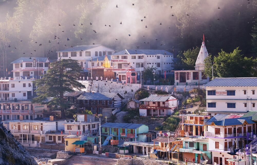
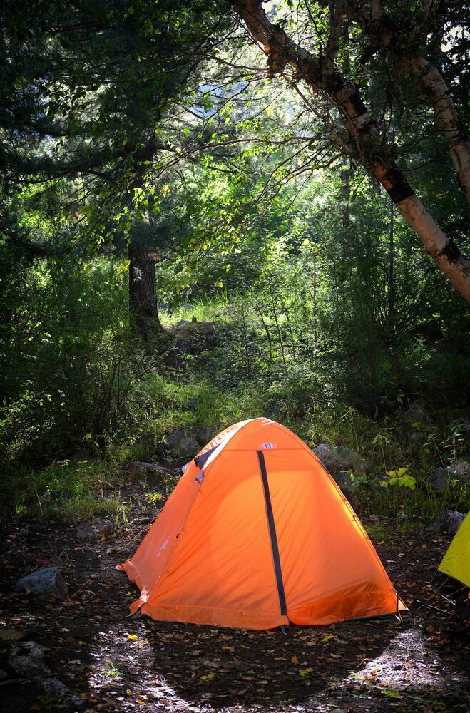
The trek starts from Gangotri which itself is at an altitude of more than 3000 m (10,000 ft). This underlies the major reason for the difficulty of the trek because unless you elect to stay a day or two at Gangotri, you are going to be inadequately acclimatized and suffer from it. The walk from Gangotry to Chirbasa is a pleasant, easy one, following the river on the side of the mountain, with a gradual and gentle ascent. The altitude gained is about 600 m (2000 ft). The campsite at Chirbasa on the banks of the river and nestled among trees is beautiful, and if not for missing this campsite and the need for acclimatization, one can easily carry on to Bhojbasa the same day.
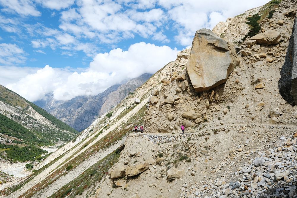
From Chirbasa to Bhojbasa takes just a little more than 2 hours and is a gain in altitude of another 250 m (800 ft). There are some beautiful views along the way and one also crosses a potentially dangerous landslide zone, but the walk is too easy and takes less than half the day.
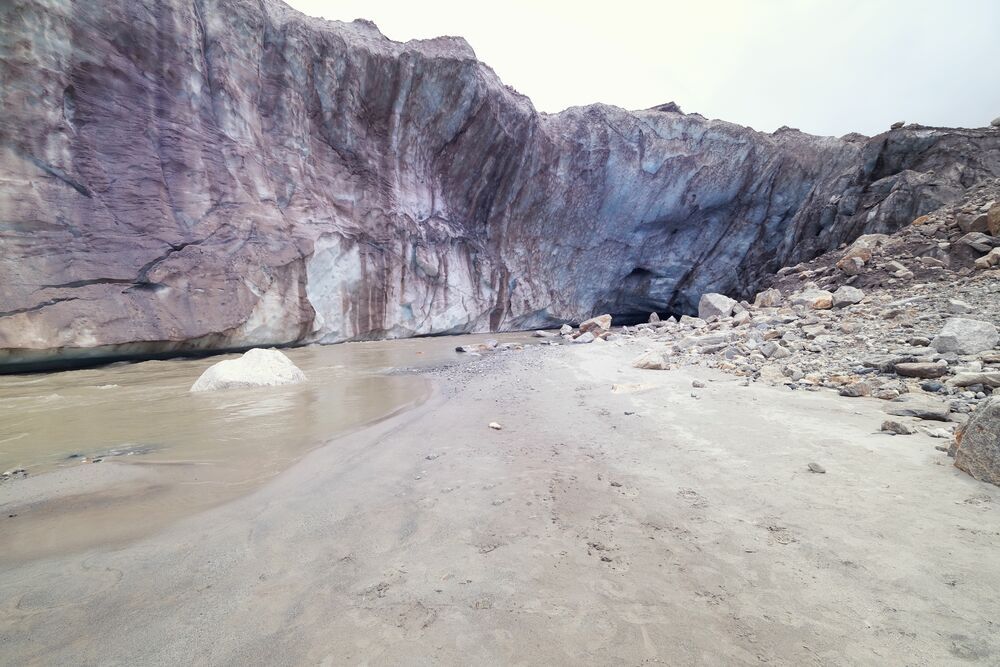
One can elect to visit Gaumukh on the way to Tapovan, but you can acclimatize by walking to Gaumukh and back, which took about 2 and half hours either way. This is shorter if you go on the left bank of the river, but after the 2013 floods, this route doesnt take you close to the glacier at all. Walking on the other bank means crossing the river, which without a bridge needs a ride in a trolley which is manually pulled across the river and walking on the same route which one takes to Tapovan, but is rewarded by a close view of the glacier which is an amazing sight.
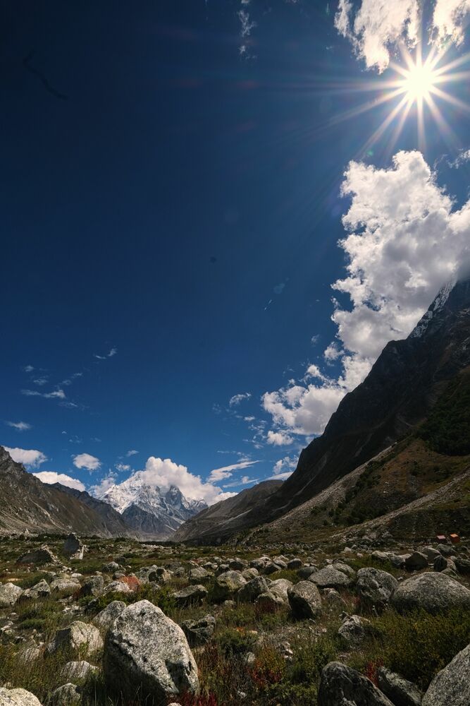
The colourful fields of flowers on the way are one of the more beautiful sights on the trek. The route to Tapovan veers off from close to the glacier on to a steep climb. With most of the route wiped out by landslides, the remnants of the steep path are slippery in places and a little scary in a couple of spots. About an hour's climb brings you to the top where the glorious sight of rolling meadows with the river Akash Ganga running along awaits you. In good weather, you can see high mountains all around, although unfortunately for us, it was cloudy and misty and raining all the time and we didnt have a good view. While it constantly rained when we were at Tapovan, it wasnt raining on the way down and the descent turned out much easier than we had expected.
Brief Itinerary as we did it
Day 1. Rishikesh to Gangotri by road (about 12 hours) Day 2. Gangotri to Chirbasa (Easy trek, 4 1/2 hours) Day 3. Chirbasa to Bhojbasa (Very easy trek, 2 1/2 hours) Day 4. Bhojbasa to Gaumukh and back (Easy trek, 5 hours) Day 5. Gaumukh to Tapovan (Moderate trek, 4 hours) Day 6. Tapovan to Bhojbasa (Easy trek, 3 hours) Day 7. Bhohbasa to Gangotri (Easy trek, 4 hours)
High points of the trek
- Easy walk until Bhojbasa. Good for beginners and those who prefer to enjoy the beautiful sights without strenuous trekking.
- Beautiful campsites.
- Gaumukh. Easily the best part of the trek is to stand in front of the glacier as it towers over you and watch the river flowing out from it. To have seen the Ganga at Rishikesh and Gangotri and walked all along the river before watching its birth like this is surreal experience.
- The views at Tapoven
Low points of the trek
- Too little trek for the trek. Having been on other week long treks, at the end this feels like not having done a full trek at all, a sentiment which was echoed by a couple of others. The problem is that the whole trek is something that can be done in three days and is stretched out only by the need to acclimatize.
- For those who are acclimatized (have stayed at Gangotri for one or two days), it is possible to do the trek with one guide by walking to Bhojbasa and staying in the GMVN accomodation there (booking at https://www.gmvnonline.com/)
- Weather. It was hot in Gangotri and on the first day of our walk, but then the weather turned cloudy, rainy and cold which spoilt the views. Trekking in September carries this risk.
How difficult is it ?
A contentious point. Perceived level of difficulty for each person is different and depends on acclimatization, fitness, experience, etc. I believe that if a trek seems very tough to you, overcoming that challenge is as big an accomplishment as climbing Everest may be to an experienced mountaineer. Still, based on the treks I have been in, and this is the tenth long trek for me, this was an easy to moderate trek in my mind. Easy on almost all parts, dipping towards moderate only on the climb to Tapovan which is a steep and slippery path with loose gravel. It is a difficult pilgrimage, but for most part an easy trek. But this ease along with some beautiful views of high mountain peaks and flower strewn meadows make it suitable for those who may prefer an easy walk.